Drones Are Mapping Mexico's Sargassum Crisis, and the Data Is Changing How Coastal Towns Fight Back |
What researchers are finding off the Caribbean coast, why Puerto Morelos is better protected than most, and what still keeps scientists up at night |
Puerto Morelos Insider
Apr 27, 2026
 |
Drones Are Now Watching Our Coastline, and What They're Finding Matters
Scientists are using drones to track sargassum along the Mexican Caribbean coast, and the data is raising serious alarms.
For those of us living in Puerto Morelos, understanding what is happening, and what is being done about it, is more important than ever.
What the Drones Are Seeing
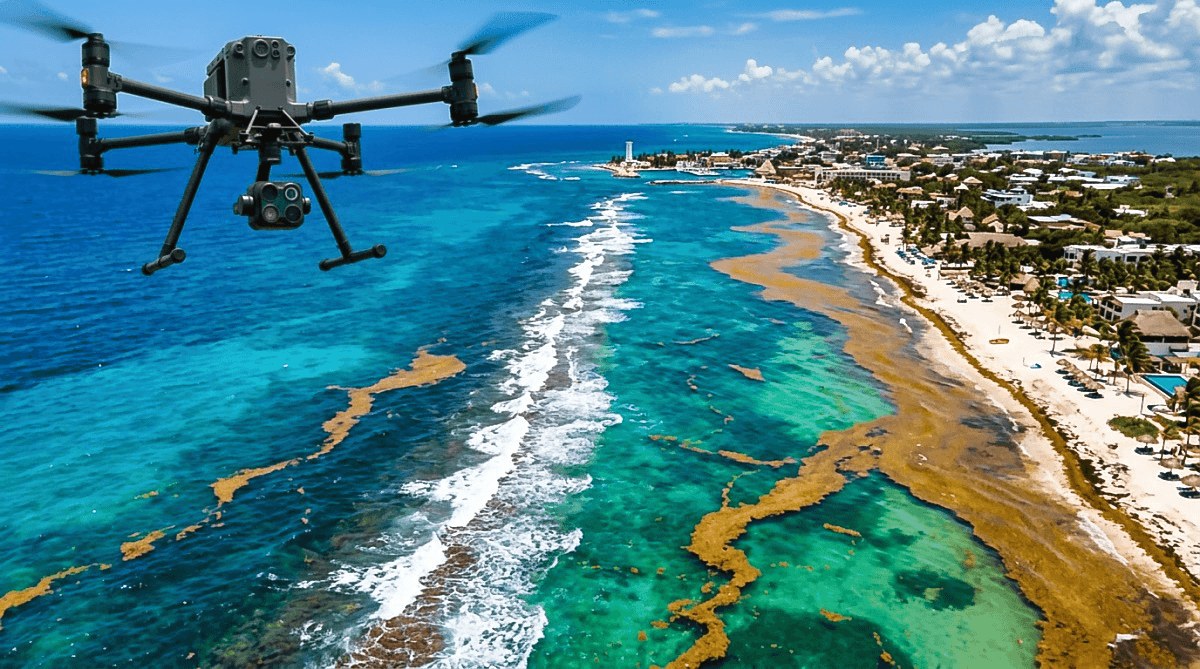
Researchers from El Colegio de la Frontera Sur (ECOSUR) are using RGB and multispectral drone technology to analyze the impact of sargassum on coastal waters.
The drones can survey large stretches of coastline with high precision, identifying where the algae is building up and helping scientists build predictive models about where it will land next.
The technology also allows researchers to differentiate between sargassum tides and pollution plumes, giving scientists a more complete picture of what is happening beneath the surface.
Down the coast, the numbers are sobering. In places like Mahahual and Xahuayxol, biomass accumulation is reaching strips of up to 25 meters, releasing leachates and toxic gases that alter water quality and create dangerous conditions for marine life.
Puerto Morelos Has a Natural Advantage
Here is something worth knowing if you live here. Puerto Morelos is in a better position than most towns along the Riviera Maya.
The Puerto Morelos National Reef Park sits directly offshore, and the natural reef barrier about 200 meters out consistently helps keep algae out of the swimming area. That reef is one of the reasons our beach stays cleaner than places like Tulum or Playa del Carmen.
But the reef is not invincible, and the threat is real. Scientists have warned that beaches in iconic sites like Puerto Morelos have already lost between 10 and 20 meters of sand, and the loss of coral reefs and seagrass meadows is described as devastating.
What Local Authorities Are Doing
The municipality is not sitting still. Mayor Blanca Merari Tziu Muñoz has been leading coordination meetings to strengthen the Sargassum Containment Plan, emphasizing that all levels of government and the private sector need to work together.
The goal is to move collected sargassum to the containment zone located at kilometer 1.5 of the Cenote Route.
In 2025, a 40-person team was collecting an average of 30 tons of sargassum per day from Puerto Morelos beaches, with additional crews added during the peak months of June and July.
Also in 2025, the Mexican Navy intercepted more than 400 tons of incoming sargassum off the Puerto Morelos coast, keeping it from ever reaching the beach.
That kind of early interception, combined with daily beach cleaning crews, is what has made a visible difference here.
The Bigger Health Picture
This is not just about aesthetics. Decomposing sargassum releases hydrogen sulfide gas, which can irritate eyes and airways and trigger headaches. During peak invasions, coastal residents often keep their windows shut.
The state of Quintana Roo is also moving forward with a large-scale biogas plant, the CISEC, which aims to convert collected sargassum into clean energy and is expected to be operational in the second half of 2026.
Puerto Morelos is also linked to a planned Circular Economy Development Hub connected to this project.
What This Means for Us
The drone monitoring program is a genuine step forward. Better data means better preparation, and Puerto Morelos has shown it can respond faster and smarter than most.
The reef helps. The cleanup crews help. The barriers help. But sargassum is not going away, and 2025 set a new record for Atlantic bloom size.
Staying informed and supporting local containment efforts is the best thing the community can do right now. |